

|
|
|

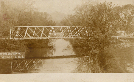 Photo: Courtesy of the Thomas J. Luddy Collection. An earlier bridge over the Wanaque River (also known as the Greenwood Lake River). This postcard image is from about 1910. This bridge has been replaced several times as shown in the below photos of the Raymond Dam. Crossing the bridge brings you from Haskell to Midvale. | |
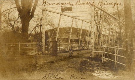 Photo: Courtesy of Mr. and Mrs. Walter McKinnon. Stella Butler at the bridge with her dog Rex in or about 1905. The Carter Paper Mill, also known as the Wanaque River Paper Company is in the background. | |
 |
 |
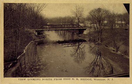
The earlier bridge (at the top of the page) was replaced by the span shown in the left postcard image from about 1915. This photo is looking west. The right photo is looking southeast and is also dated about 1915. Both images were taken from the Erie railroad trestle. |
|
 Photo: Unofficial.Net Collection. The river flowed through the Wanaque River valley from the north. This valley was flooded with the construction of the Wanaque Reservoir during the 1920's, resulting in a number of homes and farms being cleared. Several cemeteries were also moved. Later paragraphs and pages will provide additional information and photos. | |
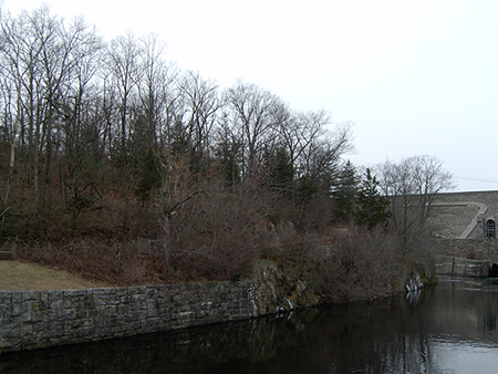 Photo: Unofficial.Net (1/2007). This recent photo shows what remains of the old Hook Rd. This road will be referred to again. It was once a main thoroughfare through the valley connecting with Westbrook Road and Furnace Road (that crosses Ringwood Avenue in Midvale). The Westbrook Road as we now know it was diverted with the construction of the reservoir. Furnace Road now ends at a smaller dam built for the reservoir. This photo shows Hook Road on the left bank of the river looking west. This section of the river comes from the reservoir spillway. Raymond Dam is at the far right. | |
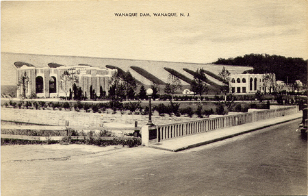 Photo: Unofficial.Net Collection. |
 Photo: Unofficial.Net (1/2007). |
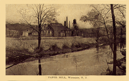 Photo: Unofficial.Net Collection. Prior to the Wanaque Reservoir, the area of the Raymond Dam was occupied by a number of homes and the Wanaque River Paper Company owned by Robert B. Carter. The paper mill was built in 1892. Prior to this, the location was the site of a grist mill. Water and power were supplied by the Wanaque River. This view is from a card postmarked Dec. 14, 1914. The sender writes, " If it were not for this mill there would be no Midvale. This does a large business and is a credit to the town", signed "George". Click here for more on the paper mill. | |
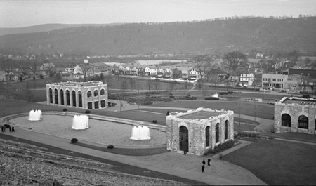 Photo: Unofficial.Net Collection. A view from the Raymond Dam showing a good section of lower Midvale and what is now Ringwood Avenue. This photograph appears to be from the late 1930's. For a closer view, click here. | |
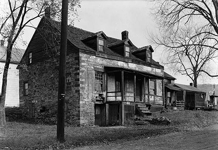 Photo: The Library of Congress, American Memory resource page. |
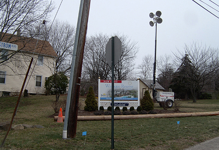 Photo: Unofficial.Net (1/2007). |
The recent photo displays an advertising billboard for the new adult community. | |
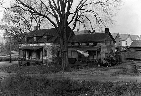 Photo: The Library of Congress, American Memory resource page. |
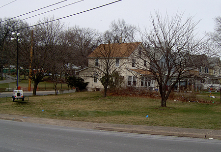 Photo: Unofficial.Net (1/2007). |
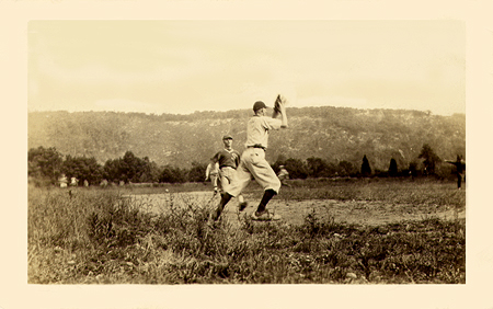 Photo: Courtesy of Bruce Batson. Baseball in the sand pit. Located off Highland Avenue (Warren Hagstrom Blvd.), it had also been called Powder Hollow and is now the site of an active adult community, Wanaque Reserve. | |
 Photo: Unofficial.Net Collection. |
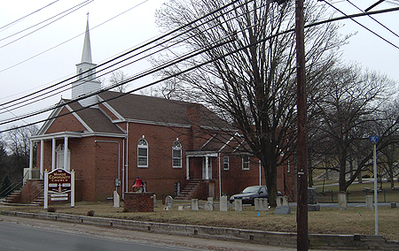 Photo: Unofficial.Net (1/2007). |
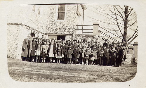 Photo: Courtesy of Bruce Batson. Group at the old Reformed Church. Click the image to enlarge. | |
 Photo: Anonymous contributor. |
 Photo: Unofficial.Net (1/2007). |
 Photo: Unofficial.Net Collection. |
 Photo: Unofficial.Net (1/2007). |
 Photo: Mike Holleran Collection. |
 Photo: Unofficial.Net (1/2007). |
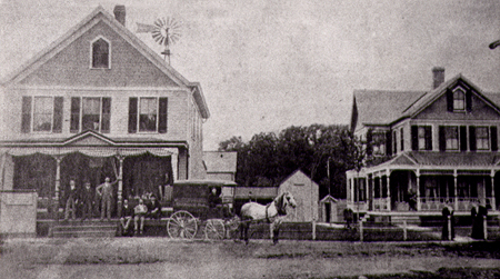 Photo: William Trusewicz Collection. The building at the corner of Lines Avenue, in this 1895 photo, was at one time the Edward J. Ricker general merchandise store. The building to the right no longer exists. Take note of the windmill in the rear of the building. | |